CULTURE ADVENTURES 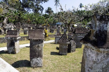
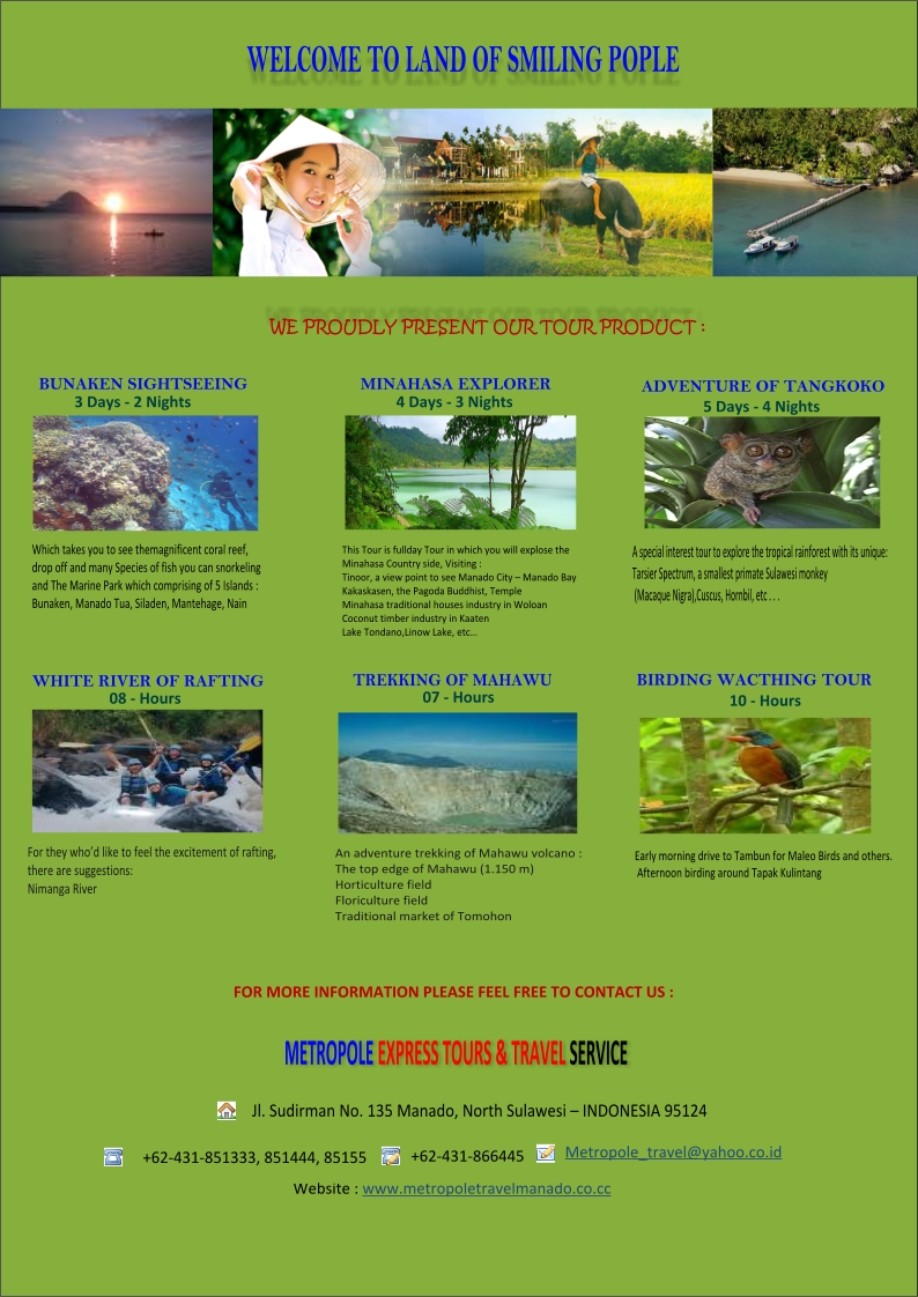
WARUGA AT SAWANGAN As archaeological remains at Sawangan village, Airmadidi, Minahasa Regency. The people call the relic ‘Waruga’. The word waruga consists of two words: waru (means a house), and ruga (means body). Therefore, it means ‘the house for the body that backs to the heaven’. From its meaning, may be you guess it as a cemetery. Yes, you are right, but it is a unique burial place for the ancestors of Minahasa. Waruga looks like a small stone monument with roof on it. It consists of two parts, the first is cubical stone with hole in it. The hole is the place where the dead body is placed. The stone is about 1 meter in width and 1 to 2 meters high. The second part is the roof, it is made from stone as well. The roof is on the cubical stone, just like a house for the living people. The oldest Waruga was built on about 900 BC. Characters are carved on each roof but not on the oldest. The carved object represents the work of the dead during their life like midwife, carpenter, hunter, etc. 104 clans are buried there. Together with the body, jewelry like ring, necklace, earring and bracelet that belong to the dead are also buried there. However, it cannot be found in the Waruga now, the government has saved them in the museum to keep it away from thieved.
MAHAWU & MT. LOKON TREKKING 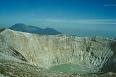
Background The elongated Mahawu volcano lies immediately east of Lokon-Empung volcano. It is the northernmost of a series of young volcanoes along a SSW-NNE line near the margin of the Quaternary Tondano caldera.
Lokon volcano 
The twin volcanoes Lokon and Empung, rising about 800 m above the plain of Tondano, are among the most active volcanoes of Sulawesi.
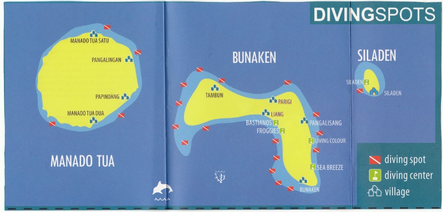
DIVING AT BUNAKEN MARINE PARK NORTH SULAWESI
DIVING AT BUNAKEN MARINE PARK NORTH SULAWESI The Bunaken National Marine Park was formally established in 1991 and is among the first of Indonesia's growing system of marine parks. The park covers a total surface area of 89,065 hectares, 97% of which is overlain by sparkling clear, warm tropical water. The remaining 3% of the park is terrestrial, including the five islands of Bunaken, Manado Tua, Mantehage, Nain and Siladen. Although each of these islands has a special character, it is the aquatic ecosystem that attracts most naturalists. The waters of Bunaken National Marine Park are extremely deep (1566 m in Manado Bay), clear (up to 35-40 m visibility), refreshing in temperature (27-29 C) and harbor some of the highest levels of biodiversity in the world. Pick any of group of interest - corals, fish, echinoderms or sponges - and the number of families, genera or species is bound to be astonishingly high. For example, 7 of the 8 species of giant clams that occur in the world, occur in Bunaken. The park has around 70 genera of corals; compare this to a mere 10 in Hawaii. Although the exact number of fish species is unknown, it may be slightly higher than in the Philippines, where 2,500 species, or nearly 70% of all fish species known to the Indo-western Pacific, are found. Oceanic currents may explain, in part, why Bunaken National Marine Park is such a treasure trove of biodiversity. Northeasternly currents generally sweep through the park but abundant counter currents and gyros related to lunar cycles are believed to be a trap for free swimming larvae. This is particularly true on the south side of the crescent-shaped Bunaken Island, lying in the heart of the park. A snorkler or diver in the vicinity of Lekuan or Fukui may spot over 33 species of butterfly fish and numerous types of groupers, damsels, wrasses and gobies. The gobies, smallish fish with bulging eyes and modified fins that allow them to attach to hard surfaces, are the most diverse but least known group of fish in the park.
LEMBEH SCUBA DIVING
Known as the “Muck Mecca”, Lembeh is famous as the best destination on the planet for what is known as exotic critter diving, macro diving, or muck diving. There are five shipwrecks (two of them Japanese WWII ships) and an impressive array of underwater topography, including pinnacles and verdant soft and hard coral gardens, but it is the plain black sand sites that make the area famous with their profusion of strange and beautiful attractions. What is considered rare elsewhere is relatively common here, including critters such as hairy frogfish, mimic octopus, mandarin fish, devilfish, flamboyant cuttlefish, ghost pipefish, seahorses, rhinopias and much much more. There is a tremendous variety of frogfish, venomous fish, snake eels, crustaceans and nudibranchs, with every dive offering an opportunity to find a species new to science. There’s something here for everyone, even the most jaded of divers. Lembeh Diving: Why The Incredible Biodiversity? Mimic Octopus, Lembeh Strait is auspiciously located in the famed “Coral Triangle”, which boasts the greatest marine biodiversity on the planet. As one move away from this area, the numbers of marine species decrease dramatically. Why are these waters so rich? It most probably is no coincidence that the largest water movement on the planet, known as the Indonesian Throughflow, splits past the northern tip of Sulawesi. To the north of Sulawesi, a string of volcanic islands form a chain all the way to the island of Mindanao in the Philippines. Below the water this chain forms the Sarangani Sill, which divides deepwater basins to the east and west. To the west is the Sulawesi Basin. To the east there is the Philippine Sea and the West Caroline Basin. The movement of water westwards from this basin begins the Indonesian Throughflow. Hitting the Sarangani Sill, the shallow portions of this water flow over this barrier and continue westward and down the west coast of Sulawesi. The deeper waters hit the barrier and are diverted southward down the eastern side of Sulawesi and through the Molluccan islands. Most of North Sulawesi lacks a continental shelf, which means that abyssal depths exist directly offshore and these deeper, nutrient-rich waters are forced upwards and churned with surface waters as they are flushed through the narrow confines of the strait. Though currents are strong in the main channel, there are numerous small bays out of the current stream suitable for easy diving in which the nutrients settle to foster the rich biodiversity that our region is renowned for.
BADDA VALLEY 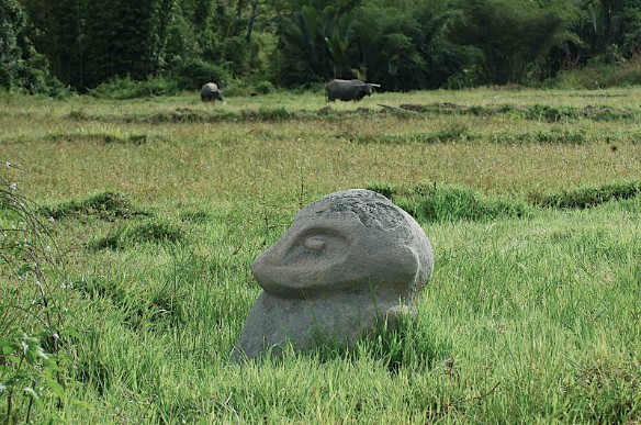
The Bada Valley follows the Lariang River along the southern border of the forested Lore Lindu National Park, and is world famous for its ancient and mysterious statues, or megaliths; megaliths are large stone carvings along the lines of those on Easter Island. Our options were many, but we decided we'd go it alone and try to find the megaliths ourselves; guides from Tentena came in at 50,000rp per day per person, which sounded like a right royal waste of money, so we bought a seat on a jeep heading east into the valley the next day, and tried to glean as much information as we could from local tour guides and other travellers. It wasn't the most successful fact finding mission; all we got was a photocopy of a dodgy-looking map and some vague walking times, but at least it confirmed that we were in the right area. And besides, a walk with a proper map just wouldn't be right in Indonesia, would it? The Megaliths of Bada Crossing the Sungai Leriang at Bomba Nobody really knows how old the Bada megaliths are, or who made them, or even why they're there. They probably date from the first millennium AD, but this figure is fairly debatable, depending on which scientist you consult. The locals don't have a clue – 'They've always been here,' is the most common response if you ask someone where the statues came from – and all this adds to a wonderful sense of mystery. Even more interestingly, all the objects in the area are made from a type of grey stone of which there are no deposits in the near vicinity, so work that one out; these megaliths are huge, heavy, and in the middle of nowhere, a long way from where they should be. There are 14 statues in total, plus many large stone vats scattered along the 15km valley. In 1984 the government persuaded the locals to build some wooden houses next to some of the megaliths, which appear to serve no purpose, and some concrete walkways around some of the more famous statues. You would assume that this makes the megaliths easy to find – it's almost set up as a tourist destination, after all, just without the tourists – but it's never that easy.
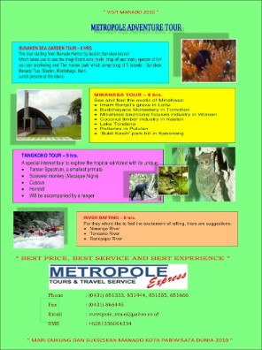
Call us today for any inquiry or booking : PT. METROPOLE EXPRESS TOURS &
TRAVEL Jln Sudirman No. 135 Manado, North Sulawesi – Indonesia 95124 Phone : +62431-851333, 851444, 851555, Fax : +62431- 866445 Mobile : +62-813-560-64-234 (SMS Reservation)
Our Others Tour Product : |
||||||||||||||||||||||||||||||||||||||||||||||||||
|
|

|
||||||||||||||||||||||||||||||||||||||||||||||||
